


Versailles Map Vintage French Garden Poster Print on Matte Paper Decorative Antique Wall Decor City Map of France Supply
Description
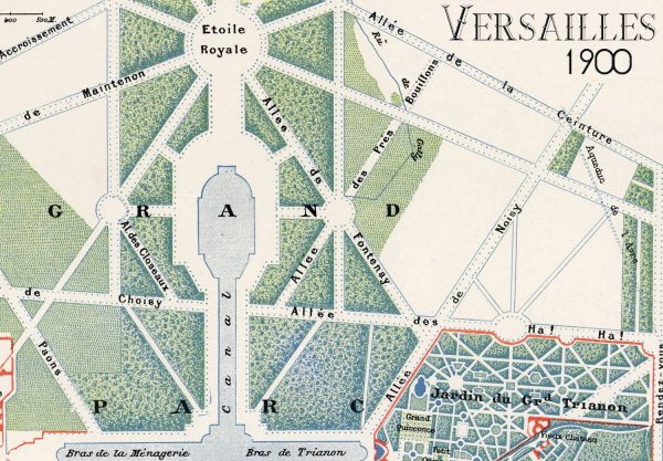
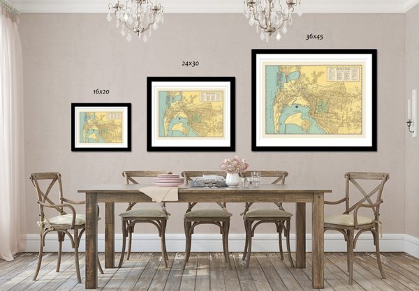
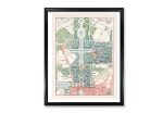
Map of Versailles 1900
This 1900 map of Versailles shows the Chateau in the lower section with above the famous gardens created by
André Le Nôtre for the Sun King Louis XIV. The size of the Grand Canal, compared to the palace, shows the massive scale of the domain.
Our Vintage Map prints come in multiple sizes on Archival Epson Enhanced Matte Paper. They are made with a 1 8 inch white border.*FRAMES ARE FOR DISPLAY PURPOSES ONLY AND ARE NOT INCLUDED WITH THIS PRINT*Available in 3 sizes:16×20 inches – $25.00
24×30 inches – $45.00
36×45 inches – $85.00
During the restoration process, we pay great attention to matching the colors to the original maps. Please note that your computer screen might display slightly different colors than our professionally calibrated monitors.
All maps are shipped rolled in a rigid tube.
Shipping info:
We offer free shipping on orders of $35.00 or more. Allow 3-5 days before shipping as our products are made to order.
Additional Information
| Size | 16×20, 24×30, 36×45 |
|---|